View count:
3521
San’in Kaigan Geopark
About San’in Kaigan Geopark[1]
In December 2008, the San’in Kaigan Geopark was designated as a Japanese Geopark by the Japan Geopark Committee. On December 4 (December 3 local time), 2010, the San’in Kaigan Geopark was admitted to the Global Geoparks Network during a conference held on Lesvos Island, Greece.In August 2014, four years after its designation in 2010, the San’in Kaigan Geopark received an on-site evaluation. On September 23 (September 22 local time), during the 6th International UNESCO Conference on Geoparks held in Stonehammer Global Geopark, Canada, the revalidation of the San’in Kaigan Geopark as a member of the Global Geoparks Network was decided. As a result, the San’in Kaigan Geopark will hold its position as a global geopark for another four years until 2018.
◆Themes and characteristics of the San’in Kaigan Geopark
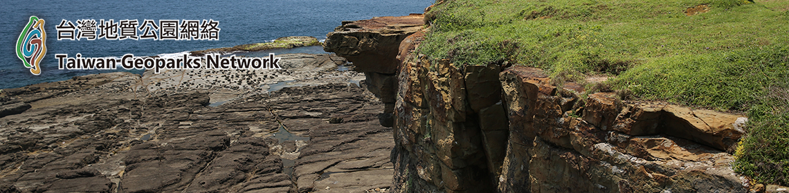
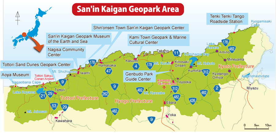
Stretching widely from Kyoto Prefecture (Kyotango City) to Hyogo Prefecture (Toyooka City, Kami Town, and Shin’onsen Town) to Tottori Prefecture (Iwami Town and Tottori City) and largely overlapping with San’in Kaigan National Park, the San’in Kaigan Geopark lies about 120 km east and west from the eastern edge of Kyotango City to the western edge of Tottori City, respectively. With an area 2458.44 km2, the Geopark is a little larger than the Tokyo Metropolitan Area.
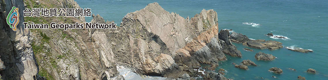
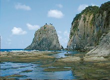
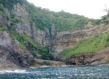
Tango Matsushima
The Geopark has had diverse geomorphological and geological features from the time when the Japan Sea was born to the present. One can observe living things, and people’s lifestyles, cultures, and histories that reflect such features.
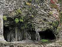
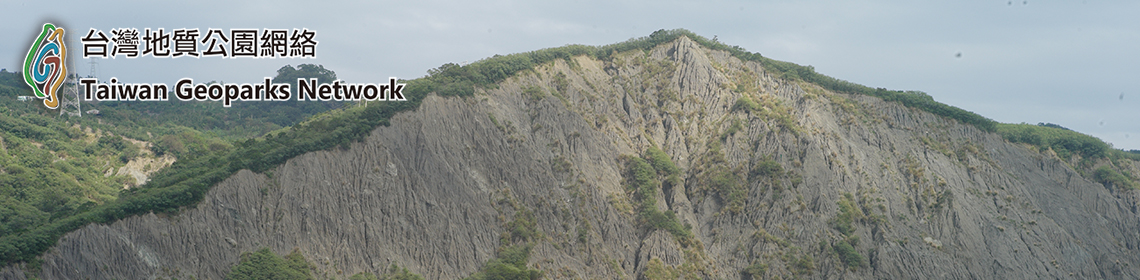
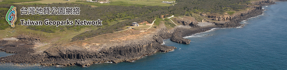
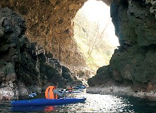
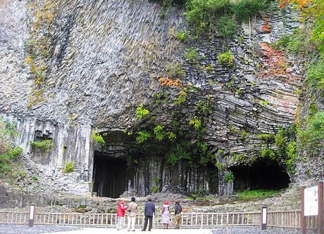
Genbudo Cave
One of the outstanding characteristics of the San’in Kaigan Geopark is that it contains many valuable geomorphological and geological assets. They include igneous rocks and geological strata that are related to the formation of the Japan Sea about 25 million years ago, and diverse coastal terrains, such as ria shorelines and dunes formed by the sea-level change and crustal movement in the Japan Sea.
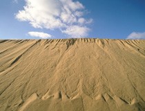
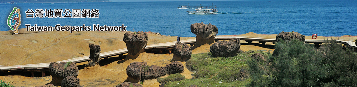
Tottori Sand Dunes
Since old days, people have inhabited the Geopark area, and so we can still observe the culture and history that they have developed in its diverse natural surroundings. Making the best of these advantages, the San’in Kaigan Geopark is conducting activities that will lead to the conservation of natural heritage and regional revitalization through local geotourism.
The Geopark’s themes Geological features, the natural environment, people’s lives, and the formation of the Sea of Japan
In the San’in Kaigan Geopark, there are varied terrain and geological conditions that range from the days when Japan was still part of the Asian Continent to today. The Geopark also has cultural and historical heritage that has developed in its diverse natural surroundings.
◆Geomorphological and geological features
(1)Distribution of various igneous rocks and sedimentary rock layers related to the formation of the Japan Sea and their exposure on the rocky coast
(2)Varied landforms along the coast of the Japan Sea
(3)Volcanic product and volcanic landform resulting from the igneous activity that continued after the formation of the Japan Sea
(4)Location where it was discovered that reversed period of geomagnetic field occurred in the Quaternary era (Basalt rock at Genbudo Cave)
(5)Abundant hot spring resources resulting from igneous activity
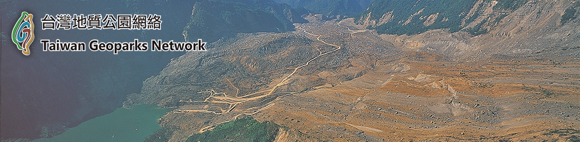
(6)Active faults and coastal terraces indicating Quaternary crustal movement that has appeared along the coast of the Japan Sea
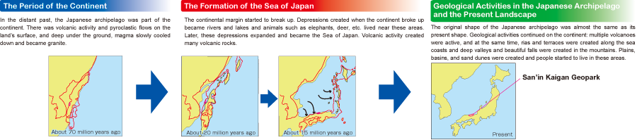
◆The history of the earth of the San’in Kaigan divided into three periods
The process in which the land where the San’in Kaigan Geopark is located was formed can be largely divided into three parts, namely “the period when Japan was part of the Asian Continent,” “the period when Japan separated from the Asian Continent and the Japan Sea was being formed,” and “the period from when the Japanese Archipelago came into being to the present.”
The San’in Kaigan Geopark, Valuable Heritage of the Earth’s Activities
Offering opportunities to observe valuable and beautiful geological formations and conditions, such as various rocks and geological strata, varied coastal forms, and waterfalls and valleys, the San’in Kaigan Geopark can be called the “heritage of the earth’s activities.”The Geopark has the following six geomorphological and geological features.
◆Geomorphological and geological features
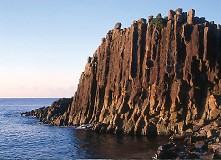
(1)Various rocks and strata related to the formation of the Japan Sea
(2)Varied coastal forms along the Japan Sea coast
(3)Volcanic activity that continued even after the formation of the Japan Sea
(4)Location where it was discovered that geomagnetic reversal occurred in the Quaternary era
(Basalt rock at Genbudo Cave)
(5)Abundant hot spring resources associated with igneous activity
(6)Active faults and coastal terraces found along the coast of the Japan Sea which indicate Quaternary crustal movement
|
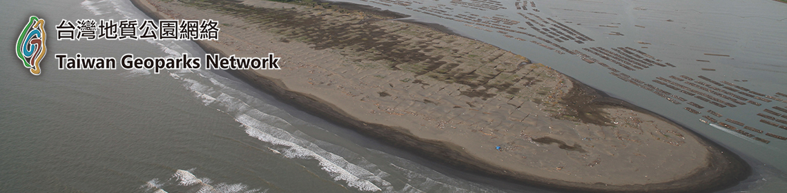
◆Dunes, sandbars Tottori Sand Dunes, Shotenkyo Sandbar, Kotohikihama Beach, etc. |
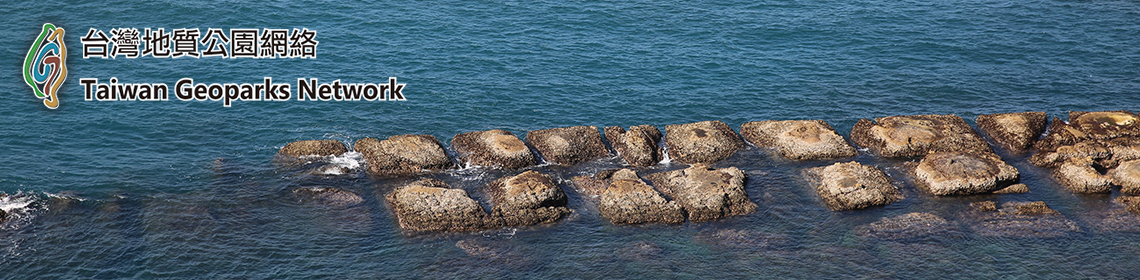
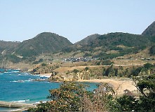
◆Coastal cliffs, coastal plateaus Kasumi Coast, Tajima Mihonoura Coast, Uradome Coast, etc. |
◆Rock caves, marine caves Yodono Domon Rock Cave, Nihon Domon Rock Cave, etc. |
||
 |
 |
 |
||
| Tottori Sand Dunes | Kasumi Coast | Yodono Domon Rock Cave |
|
◆Coast terraces Sodeshi, Fudeshi, Tango Matsushima, Kyogamisaki, etc. |
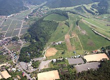
◆Volcanoes Kannabe Volcano Group |
◆Geological strata Nekozaki Peninsula, Matsugasaki Hyakusogai Cliffs, etc. |
||
 |
 |
 |
||
| Fudeshi | Kannabe Volcano | Matsugasaki Hyakusogai Cliffs |
|
◆Joints Tateiwa Rock, Genbudo Cave, Yoroinosode Cliffs, etc. |
◆Faults Gomura Fault, Shikano Fault, etc. |
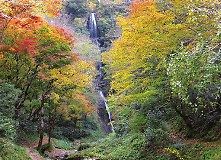
◆Waterfalls Saruotaki Waterfall, Amedaki Waterfall, Yoshitaki Waterfall, etc. |
||
 |
 |
 |
||
| Tateiwa Rock | |
Gomura Fault | Saruotaki Waterfall |
International Importance
Genbudo Cave in Toyooka City, Hyogo Prefecture, is the place where it was discovered that geomagnetic reversal occurred in the Quaternary era (dating from 2.6 million years ago to the present). In 1926, Dr. Motonori Matuyama of Kyoto University discovered that basalt at Genbudo Cave exposed by a volcanic eruption about 1.6 million years ago had a polarity opposite to the present geomagnetic field.This discovery indicated that there was a period in which the earth’s magnetic field was opposite to what it is today. Called “Matuyama reversed chron” (dating from about 0.8 million to 2.6 million years ago), the discovery of the reversed period of geomagnetic field has greatly contributed to the development of the theory of plate tectonics.
In June 2009, an international agreement was made to recognize the Matuyama reversed epoch as indicating the beginning of the Quaternary era, making it an index to be used for determining the boundary between two different geological eras.
Genbudo Cave (basalt rock) was exposed by a volcanic eruption about 1.6 million years ago.
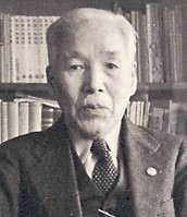
Dr. Motonori Matuyama
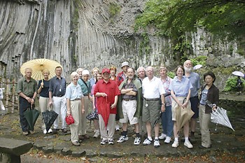
The cave receives many visitors from abroad.
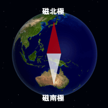
In the Quaternary era, the earth had a polarity opposite to the present geomagnetic field.
Rich Ecosystem (Flora and Fauna)
Blessed with varied natural surroundings, the San’in Kaigan area is home to a wide variety of valuable seaside plants and animals. With its geological diversity supporting its biodiversity, the San’in Kaigan accommodates many different species of flora and fauna.◆Plants in the Geopark
Having varied geomorphological and geological features, each area of the San’in Kaigan Geopark has its unique species of plants.
In the rocky coastal region, for example, various marine algae, such as sargasso (Sargassum fulvellum) and wakame seaweed (Undaria pinnatifida), adhere to rocks, forming submarine forests. Sand beaches are inhabited by plants adapted to sandy soil and a dry climate, such as sea bells (Calystegia soldanella) and chaste tree (Vitex rotundifolia).
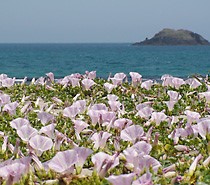
Sea bells
Plenty of evergreen broadleaf forests remain in the precincts of old shrines located along the coastal areas.
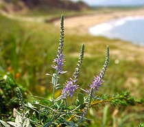
Veronica ornata
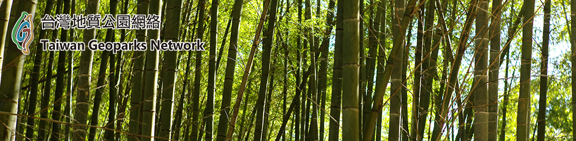
Meanwhile, ancient forests consisting of deciduous broad-leaved trees, such as Japanese beech, spread across the inland mountain areas, such as the area around Mt. Oginosen.
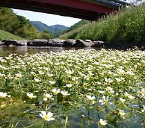
Baikamo (Ranunculus nipponicus) community
Moreover, one can see plants characteristic of each area all through the year. They include Veronica ornata, which grows naturally only in the Japan Sea coastal area and is the symbol flower of Kyotango City, late yellow daylily (Hemerocallis citrina), which grows in the seaside areas of Kasumi, Kami Town, Baikamo (Ranunculus nipponicus) colonies by Takimi River in Shin’onsen Town, whose existence indicates that the natural environment around it is in good condition, colonies of rabbit-ear iris (Iris laevigata) in the Karakawa Wetland, Iwami Town, and wetland vegetation found in Onuma Marsh in the Hachikita Highlands in Kami Town.
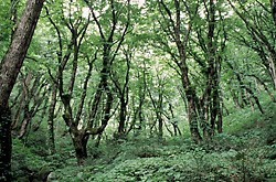
Japanese beech trees
About by Unique Geomorphological and Geological Features
◆Geomorphological and geological features underlying people’s lives
The San’in Kaigan Geopark has been growing various local products using its diverse and undulating terrain. In particular, the sea off the San’in region abounds with varied reefs, providing an environment accommodating to fish. Blue crab fishing grounds lie in the waters at 200-400 meters below sea level between the coast and continental slope of the Japan Sea. At deeper water levels, red snow crabs are caught.
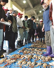
Auctioning crab caught off the San’in region
The Japan Sea at a level deeper than 200 m is filled with cold water known as the “Japan Sea proper water,” with the Tsushima Warm Current circulating in the surface layer. As a result, its medium layers and deep sea are inhabited by such cold-water fish species as sandfish and porous-head eelpout, and its surface layer by warm-water species such as bluefin tuna and flying fish.
In the Yamato Basin located almost at the center of the Japan Sea, the Tsushima Warm Current merges with the cold middle-layer water mass, creating major fishing grounds of such species as snow crab, flathead flounder, and kurozakoebi (Argis lar).
The Geopark contains the San’in region’s leading fishing grounds, where species such as snow crab and kurozakoebi (Argis lar) are caught. Compared to the Pacific region, fish species are more diverse in the Japan Sea, and so we can enjoy delicious fish of each season all through the year.
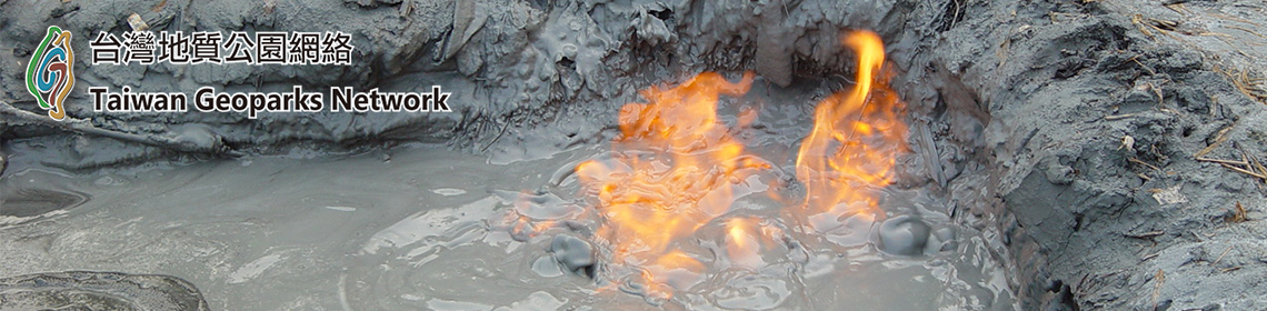
In the Geopark, there are also many hot springs along the faults. Among them, Kizu Onsen (Kyoto Prefecture), Kinosaki Onsen and Yumura Onsen (Hyogo Prefecture), and Iwai Onsen (Tottori Prefecture) are particularly outstanding spa resorts that are over 1,000 years old and have always been loved by distinguished people. There are some episodes concerning the discoveries of these hot springs, which are unique to this snow-bound region. Together with their histories, the widely scattered hot spring resorts make the entire region a major tourist area.
In the Yamato Basin located almost at the center of the Japan Sea, the Tsushima Warm Current merges with the cold middle-layer water mass, creating major fishing grounds of such species as snow crab, flathead flounder, and kurozakoebi (Argis lar).
The Geopark contains the San’in region’s leading fishing grounds, where species such as snow crab and kurozakoebi (Argis lar) are caught. Compared to the Pacific region, fish species are more diverse in the Japan Sea, and so we can enjoy delicious fish of each season all through the year.
In the Geopark, there are also many hot springs along the faults. Among them, Kizu Onsen (Kyoto Prefecture), Kinosaki Onsen and Yumura Onsen (Hyogo Prefecture), and Iwai Onsen (Tottori Prefecture) are particularly outstanding spa resorts that are over 1,000 years old and have always been loved by distinguished people. There are some episodes concerning the discoveries of these hot springs, which are unique to this snow-bound region. Together with their histories, the widely scattered hot spring resorts make the entire region a major tourist area.
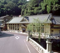
Kinosaki Onsen spa resort
In the Hachibuse area, a major landslide region comprising the Hokutan Group and Teragi Group, one can enjoy various attractions, such as landscapes of terraced rice paddies using the area’s geomorphological features, skiing in winter, and paragliding and grass skiing in summer. Mt. Kannabe, a Quaternary volcano with a slope gradient ranging from 20 to 30 degrees, is also used as a ski slope.
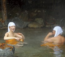
Iwai Onsen spa resort
There are other activities that make the most of the San’in region’s geomorphological and geological features, such as seaweed picking on the wave-cut benches and making terraced rice paddies on the coastal terraces.
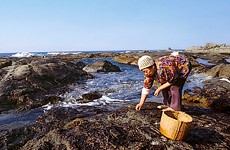
Picking seaweed on a wave-cut bench
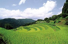
Terraced rice paddies using landslide terrain
◆Coexistence of people and nature
In the San’in Kaigan Geopark, efforts are being made toward the creation of a sustainable local community by conserving the region’s geological heritage and other resources through concerted efforts of local people, private organizations, companies, and government, and by utilizing such heritage and resources for education, tourism, and local industries.
Rakkyo field using sand dunes
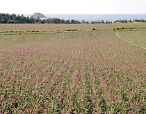
◆Rakkyo (Allium chinense) in the Tottori Sand Dunes (Tottori Prefecture)
In the Tottori Sand Dunes, desert afforestation research is conducted under the leadership of the Arid Land Research Center, Tottori University. Also, sand dune rakkyo is grown extensively, making the best of its geological advantages. Every year, from late October to early November, purple-red rakkyo flowers bloom in the vast, 110-hectare field.
Sand dune melon
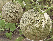
◆Fruit growing in the Tango Sand Dunes (Kyotango City)
In the Tango Sand Dunes, Kyotango City, fruits are grown extensively on the sand dunes. In summer, fruits with high sugar content, such as watermelon and melon, are harvested. A brand-name sweet potato known as “Kyokansho” is also produced here.
◆Animals in the Geopark
The San’in Kaigan Geopark is a habitat of many wildlife species, many of which have been designated as endangered natural monuments and are under protection.
Among the species designated as endangered on the Red List of Japan’s Environment Ministry are a bird known as golden eagle (Aquila chrysaetos; Government-designated natural monument) living in the highlands around Mt. Oginosen and Mt. Hachibuse, an amphibian called Abe’s salamander (Hynobius abei) inhabiting only some areas in Omiya-cho, Kyotango City, and Hidaka-cho, Toyooka City (both localities are registered as habitat conservation areas of the species), and an insect called four-spot midget (Mortonagrion hirosei) living in the wetlands along the Maruyama River.
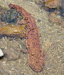
Japanese giant salamander
The Geopark is also home to such government-designated special natural monuments as oriental white storks and the Japanese giant salamander, a “living fossil,” and to the natural monument Japanese Silverlines (Spindasis takanonis) inhabiting the foot of Mt. Kyusho, Tottori City.

Oriental white stork
In the Toyooka Basin, the last remaining habitat of oriental white storks in Japan, community-wide efforts are being made around the Hyogo Park of the Oriental White Stork to restore their habitat and reintroduce them to the wild. Over 100 oriental white storks are being bred in the Park, which also contains an exhibition cage and observation site designed to enable visitors to observe the storks from up close.
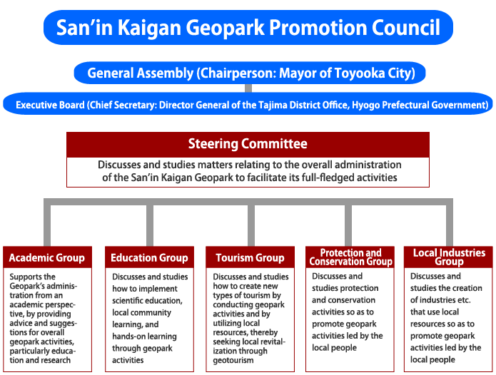
San’in Kaigan Geopark Governing Structure
[1] http://sanin-geo.jp/en/