View count:
3131
Location
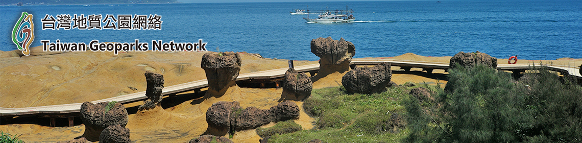
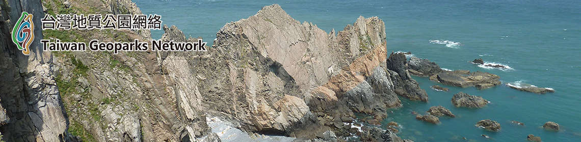
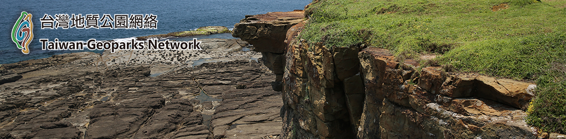
The Northern Coast Bitou – Longdong Geopark which spreads about 1km-long coast with a bay of clear waters is the first geopark established in the northeast and Yilan area of Taiwan. Its name reveals two main parts forming this geopark being Bitou cape and Longdong bay.
Bitou cape situated about 85km far from Nanya on the Coastal High is featured by breathtaking landscapes of many majestic vessel-like erosion cliffs, mushroom rocks standing uniformly upon erosion platforms surrounding by crystal blue ocean. The name Bitou Cape, meaning Tip-of-the-Nose in Chinese, derives from the cape landform that spurs into the ocean in the shape of a nose. The contract of the steep, protruding and angulating cape with the under towering cliffs, waves wait in line to crash upon them, naturally revealing the grandeur of Mother Nature.
Geologically speaking, Bitou Cape lies on the intersection of the east-west trending coast and the north-south coast, eroded by stormy wave perennially throughout the year. Bitou Cape is regarded as a marine processes boundary, the sea arch north of Bitou Cape belongs to East China Sea and the south belongs to the Pacific Ocean.
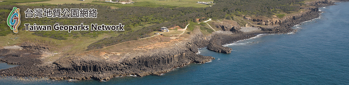
Toward the southern of Bitou cape is Longdong bay. The origin of the name Longdong (dragon’s cave) is from the shape of the region’s coastline, similar to the shape of a dragon lying down. Along the coastline are a series of hard, steep rising sandstone formations. These rocks with clear cut joints stand erect and close to the ocean, vigorously announcing their presence. With the impressive sea cliffs which are composed of extremely hard rock, Longdong provides a popular rock climbing zone with unique landform and geological views.

[1] Lin, J. C., Su, S. C. (2019). Geoparks of Taiwan. Their development and Prospects for a Sustainable Future.