View count:
2800
Attractions
1. Attractions[1]
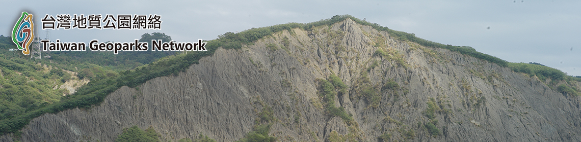
The abundant geographical resources of the Northeast Coast offer surprises at each and every corner. In a way, the Northeast Coast is in fact a miniature projection of Taiwan, as it developed from an area of sunken land on the coast of South China that was then pushed up from the seas into a mountainous island. This was a period of great changes, a time of fierce evolution that has carved itself into Longdong Cape's ancient and adamant sandstone walls, and recorded itself into Bitou Cape's sediment beds.
a. Geology and Landscape
a. Geology and Landscape
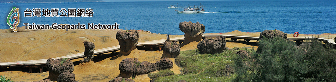
Fugui Cape Park has a "sand stabilizing wall” that prevents the sand dunes from being eroded by the wind. Shimen Cave is a sea cave created by marine erosion. Yehliu Geopark is located on a long and narrow cape that juts into the ocean. It has the well-known noble-looking Queen's Head Rock and also the Cute Princess that appeared in 2010, both created by weathering. Guanyinshan was given its name because of its resemblance to a reclining Guanyin Buddha. It also has a rich deposit of a well-known building material—Guanyin rock (andesite).
The abundant geographical resources of the Northeast Coast offer surprises at each and every corner. In a way, the Northeast Coast is in fact a miniature projection of Taiwan, as it developed from an area of sunken land on the coast of South China that was then pushed up from the seas into a mountainous island. This was a period of great changes, a time of fierce evolution that has carved itself into Longdong Cape's ancient and adamant sandstone walls, and recorded itself into Bitou Cape's sediment beds.
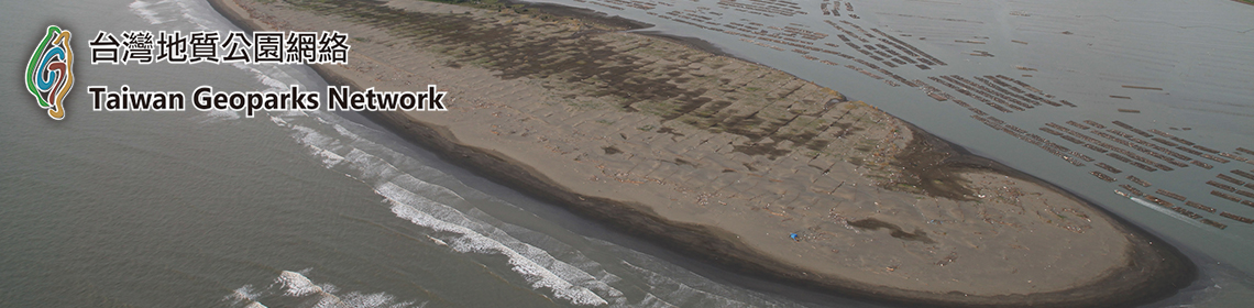
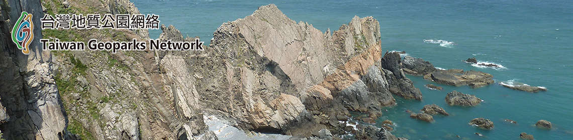
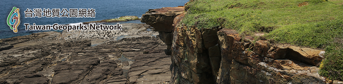
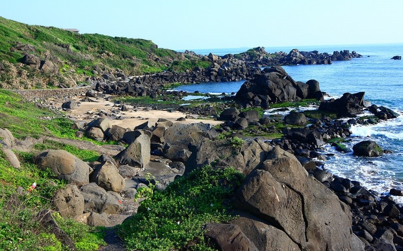
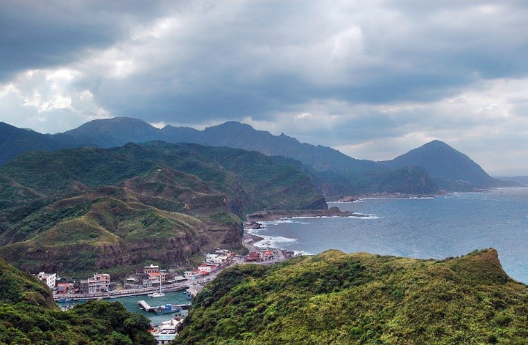
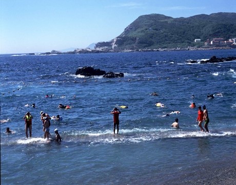
The Cape of San Diego forms one border of the coastline landform. To the north of San Diego is a typical ria landform, where rock formations have been sculpted through erosion, abrasion, weathering, displacement, and other natural forces, forming mushroom-shaped rocks, tofu-like chessboard rocks, hive-like honeycomb rocks, and other naturally formed rock formations such as Nanya area's erosion-formed striated rock formations; Bitou Cape's intriguing mushroom rocks, sea cliffs, platforms, undercut bluffs, and other erosion landforms such as; a three mile stretch of golden beach between Yanliao and Fulong; Longdong Cape's steep sandstone cliffs; Lailai and Ying-ge's prominent wave-eroded platforms; and finally, Beiguan's extraordinary cuestas and tofu rock landforms. As for Nanfangao, it was originally an island, but gradual sand deposition led to its connection with the mainland, forming an isthmus. The coastline geological views seen here are capes, reefs, cliffs, and erosion caves.
The diverse coastal landforms seen along the Northeast coast continues to reveal the unique nature of this area's geological background and development. It is indeed the perfect place for appreciation of the beauty of the land.[2]
The wind-polished stone
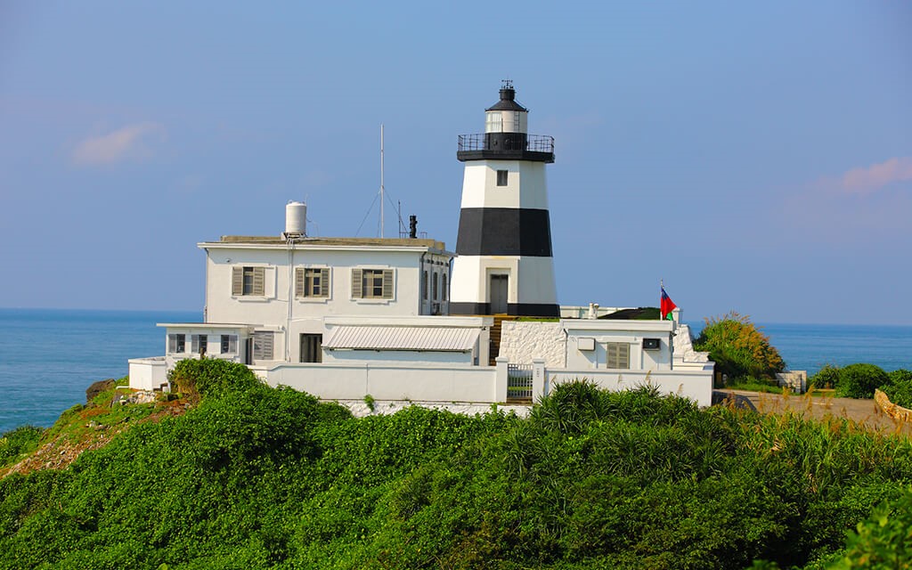
Cape Fugui Lighthouse
The abundant geographical resources of the Northeast Coast offer surprises at each and every corner. In a way, the Northeast Coast is in fact a miniature projection of Taiwan, as it developed from an area of sunken land on the coast of South China that was then pushed up from the seas into a mountainous island. This was a period of great changes, a time of fierce evolution that has carved itself into Longdong Cape's ancient and adamant sandstone walls, and recorded itself into Bitou Cape's sediment beds.
The Cape of San Diego forms one border of the coastline landform. To the north of San Diego is a typical ria landform, where rock formations have been sculpted through erosion, abrasion, weathering, displacement, and other natural forces, forming mushroom-shaped rocks, tofu-like chessboard rocks, hive-like honeycomb rocks, and other naturally formed rock formations such as Nanya area's erosion-formed striated rock formations; Bitou Cape's intriguing mushroom rocks, sea cliffs, platforms, undercut bluffs, and other erosion landforms such as; a three mile stretch of golden beach between Yanliao and Fulong; Longdong Cape's steep sandstone cliffs; Lailai and Ying-ge's prominent wave-eroded platforms; and finally, Beiguan's extraordinary cuestas and tofu rock landforms. As for Nanfangao, it was originally an island, but gradual sand deposition led to its connection with the mainland, forming an isthmus. The coastline geological views seen here are capes, reefs, cliffs, and erosion caves.
The diverse coastal landforms seen along the Northeast coast continues to reveal the unique nature of this area's geological background and development. It is indeed the perfect place for appreciation of the beauty of the land.[2]
The wind-polished stone
Cape Fugui Lighthouse
b. Culture attractions
North Coast
Sanzhi did not develop into a Han society until early 20th century. However, the local residents have performed well continuously and made it an admirable district, especially in culture and humanities.
In Shimen, there used to be a traditional Katagalan village with a long history, named "Alilo," meaning "The Land by the Sea." There were semi-pit stone houses of about only two meters in height.
Jinshan is the place on the northern coast with the earliest human developments. Jinbaoli, the earlier name of Jinshan and meaning "harvest," had been a well-developed tribal village of the Pingpu people by the 17th century. And in the 18th century, streets were formed in the place which is now the bustling area of Jinshan.
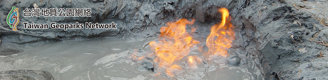
The Masu River in Wanli flows through an area over a fault. The left side, where there are platforms suitable for farming, is the area where most of the residents of the district live. And the right side is a place of sedimentary rock with many coal mines.
Guanyinshan
The delta formed at the estuary of Tamsui River on the Bali side provided a good place for Dapengkeng and Shisanhang cultures to develop. However, with limited hinterlands, this place developed into a transfer point between the sea and the Taipei Basin for the early settlers. Lingyun Temple is the religious center of this area.
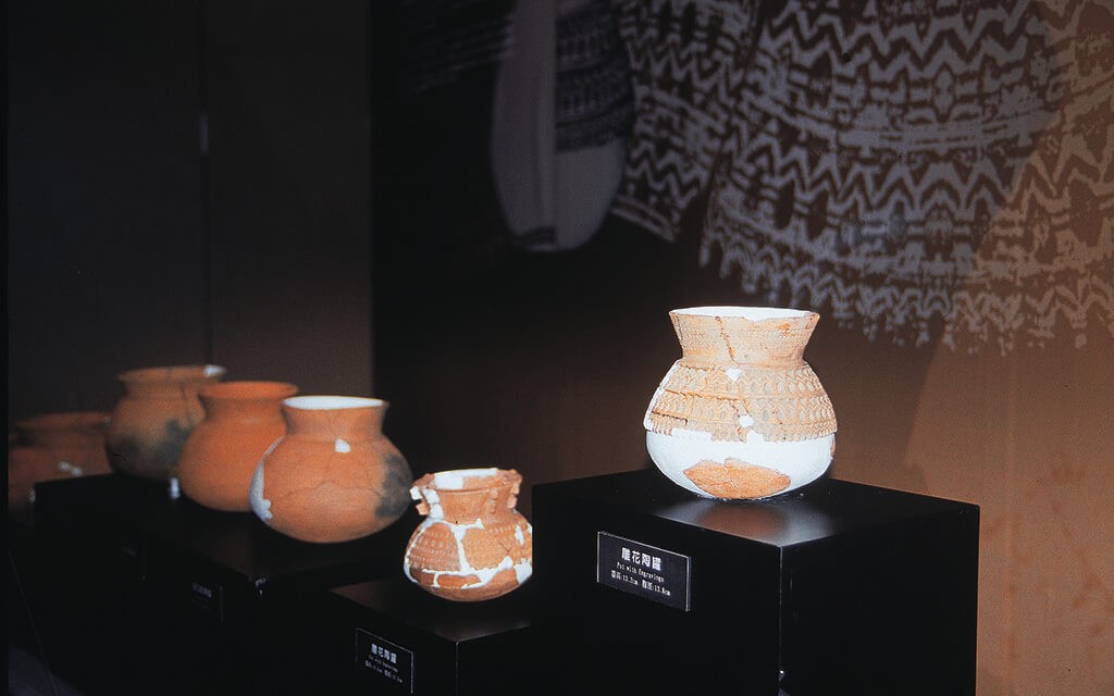
A historic site found by archaeologists
Come for a tour of culture! The Northeast coast and Yilan coastline not only offers spectacular views that tourists will find hard to resist, the unique cultural sights will also let tourists linger around for more!
Sanzhi did not develop into a Han society until early 20th century. However, the local residents have performed well continuously and made it an admirable district, especially in culture and humanities.
In Shimen, there used to be a traditional Katagalan village with a long history, named "Alilo," meaning "The Land by the Sea." There were semi-pit stone houses of about only two meters in height.
Jinshan is the place on the northern coast with the earliest human developments. Jinbaoli, the earlier name of Jinshan and meaning "harvest," had been a well-developed tribal village of the Pingpu people by the 17th century. And in the 18th century, streets were formed in the place which is now the bustling area of Jinshan.
The Masu River in Wanli flows through an area over a fault. The left side, where there are platforms suitable for farming, is the area where most of the residents of the district live. And the right side is a place of sedimentary rock with many coal mines.
Guanyinshan
The delta formed at the estuary of Tamsui River on the Bali side provided a good place for Dapengkeng and Shisanhang cultures to develop. However, with limited hinterlands, this place developed into a transfer point between the sea and the Taipei Basin for the early settlers. Lingyun Temple is the religious center of this area.
A historic site found by archaeologists
Come for a tour of culture! The Northeast coast and Yilan coastline not only offers spectacular views that tourists will find hard to resist, the unique cultural sights will also let tourists linger around for more!
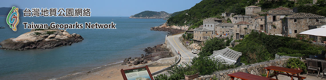
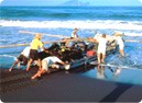 Taiwanese Beach Seine |
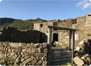 Mao-ao Fishing Village |
 Dali Tian-gong Temple |
Feel the serenity and simplicity of a small fishing village from an old path, with the setting sun and a gentle sea breeze. Gaze at each beautiful carved resolute face, with the marks of their continuous struggle for survival. These are the people who manage to live in harmony with nature under the roaring waves. Their lives, beliefs, and principles all deserve our careful consideration.
A hundred year old path from the Qing Dynasty- Caoling Historic Trail; a testimony to the world of the war against the Japanese- Yanliao Anti-Japanese Memorial; the Cape of San Diego Lighthouse and Bitou Lighthouse, both decades-old guides for ships; an old, modest village that tells the tale of a stream humming a love song with the waves- Maoao Fishing Village; a garden symphony of gentle streams singing, cows casually grazing, white egrets and spacious green meadows -Yuanwangkenkou; many sanctuaries for the soul- Lingjioushan Wusheng Taoist Temple, Silingyan Temple, Dali Tiangong Temple, Gongnan Temple, Shihguanying Temple, Mingshan Temple, Jhuangwei Yongjhen Temple, Nanfangao Nantian Temple, and much more. In short, these cultural treasures will be well worth your enjoyment![3]
c. Bitou Cape[4]
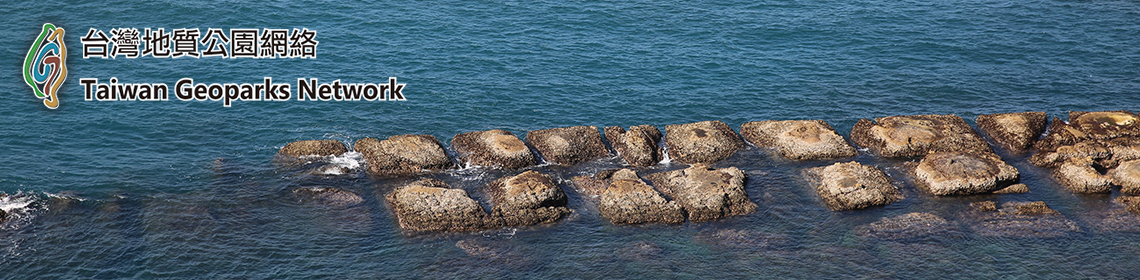
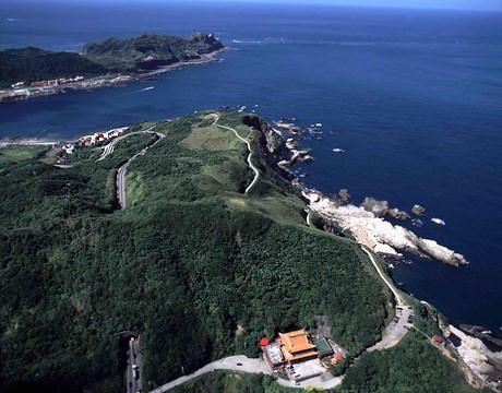
Bitou Cape is one of the Three Capes of North Taiwan, the other two being Fugui Cape, the island's northernmost cape, and Sandiao Cape (Sandiaojiao), its easternmost. Most of the sea-eroded landform types of the entire Northeast Coast are found here, including the sea cliffs, undercut bluffs, and platforms which are more fully developed here than anywhere else in Taiwan. The sea-eroded platforms are thick with mush-room-shaped rocks, honeycomb rock, tofu (bean curd) rock, and marine fossils, all of which make this an outstanding natural geological classroom.
A paved footpath leads off beside the Bitou Elementary School here and onto the cape, giving access to splendid vistas of sea and sky. The path terminates at the tip of the cape and Bitou Cape Lighthouse, which was first constructed in 1896 and was rebuilt in its present form after being destroyed by Allied bombing during World War II.
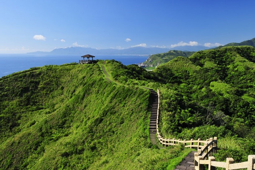
Bitou cape
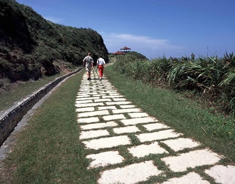
Bitou Cape Hiking trail
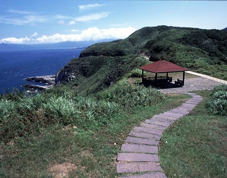
Overlooking the crystal blue ocean from Bitou Cape Park
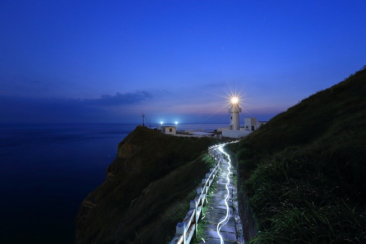
Bitou Cape Lighthouse
A paved footpath leads off beside the Bitou Elementary School here and onto the cape, giving access to splendid vistas of sea and sky. The path terminates at the tip of the cape and Bitou Cape Lighthouse, which was first constructed in 1896 and was rebuilt in its present form after being destroyed by Allied bombing during World War II.
Bitou cape
Bitou Cape Hiking trail
Overlooking the crystal blue ocean from Bitou Cape Park
Bitou Cape Lighthouse
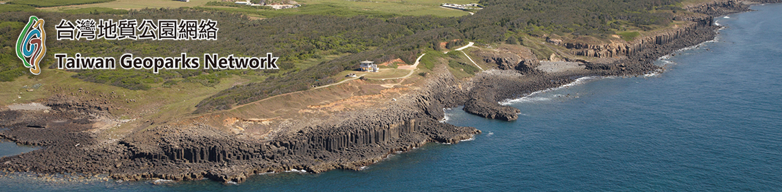
d. Longdong Ocean Park (Bitou and Longdong Bay Geological Park)
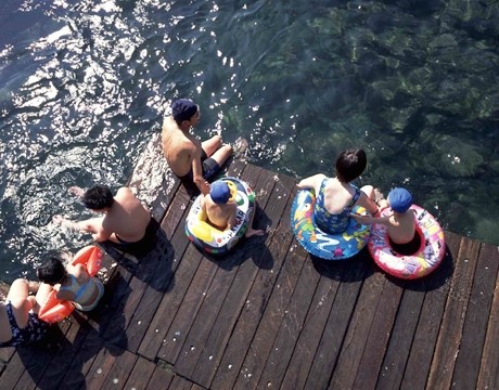
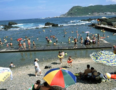
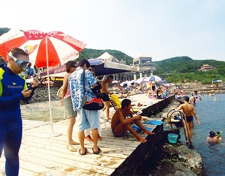
The Bitou and Longdong Bay Geological Park has a 1km-long coast and a bay of clear waters. There are 25 kinds of fish from 80 genera in the bay, such as labridae, pantodontidae, pomacentridae and hepatidae. Blue damselfish are the most common species and their colors are mesmerizing. There is a water playground, a scenic café, a geological exhibition room and a coastal ecology classroom. This is a great place for swimming, fishing, scuba diving and snorkeling.
Oceanic Playground
The oceanic playground has been adapted from an illegal baby abalone farm. Today, it is paved with round pebble stones and full of clear waters. Except in the northeast monsoon seasons, it is smooth and peaceful. This is the best place to take water activities on the Northeast Coast, such as swimming, water play, scuba diving and snorkeling.
Children’s Playground
The beautiful Children’s Playground is filled with sea waters. The depth of water is just right; children can have as much fun as they like here.
Attic of Seas and Waves
You can gaze at Bitou Cape, Sandiao Cape and Longdong Bay from any corner of the attic. Take a look at the steep cliffs south of the Longdong Cape and you’ll be amazed. What makes this attic special is that large windows are used to create scenic views, and each of them looks like a graceful painting. It is a soul-refreshing experience sipping a cup of aromatic coffee away from the crowds, no matter in the day or the night.
Coastal Café
The Coastal Café is located on a square north of the parking lot. Looking out from the glass windows and you’ll see the beautiful Longdong Bay. Stone walls and floors, melodious music and vast ocean views make it an especially pleasant place to stay. On a clear day, you can sit beside a patio table, sip a cup of coffee and look at the blue sea and the sky as breezes blow.
Geological Exhibition Room
The Bitou and Longdong Bay Geological Park is the most special geological site on the Northeast Coast. At its Geological Exhibition Rom, there are detailed pictures and texts that explain all kinds of geological wonders, such as sea-eroded formations, sea-eroded cliffs, sea-eroded caves, sea-eroded platforms, marine terrace, and sea grooves. Appreciating these artistic works crafted by nature is one of the best ways to get close to it.
Costal Ecology Classroom
The open-air Coastal Ecology Classroom includes a sea-eroded platform and a 100 meter-long intertidal zone near the Oceanic Playground. On the platform are winkles, sea anemones and sea hares. In the intertidal zone are also sea anemones, winter aconites, small rock oysters, hermit crabs and all kinds of algae. This is a highly educational coastal ecology classroom formed in nature.
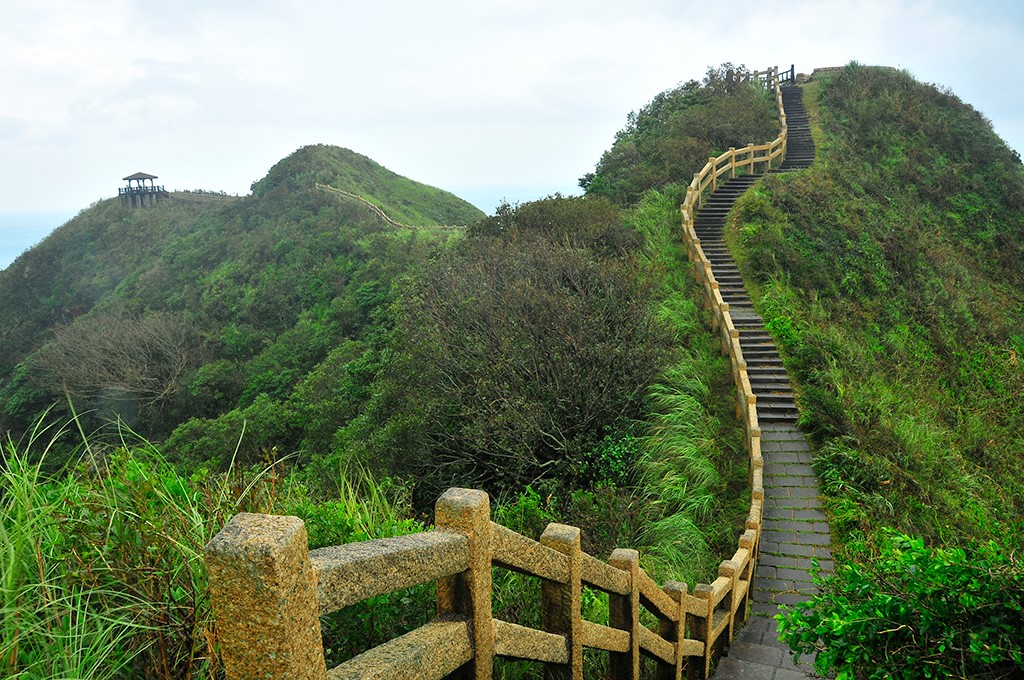
e. Longdong Bay Cape Trail
The Longdong Bay Cape Trail not only links up the two largest capes of the Northeast Coast, Bitou and Longdong Capes. By doing so, it has also bridged the gap between two different geological eras, one that took place six million years old and the other 35 million years ago. Walking on the three-km long trail is like strolling through time and space. With every step taken, you shall become more interested the earth’s history. The trail starts from the north parking lot of the Longdong South Ocean Park and leads to the Xilingyan Temple after 97 steps. Along the way, you’ll see many different native coastal plants. When you are finished with the stone-paved section, you can first take a side path north of Hemei Elementary School and then switch to a community trail that leads to the Longdong Ocean Park. A round trip between the Longdong South Ocean Park and Hemei Elementary School is about 1.5 hours. If you go all the way to the Longdong Ocean Park, a round trip is about 3 hours. You can freely decide which trip to take, depending on how strong you are.
f. Longdong South Ocean Park(Longdong Four Seasons Bay)
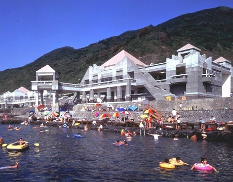
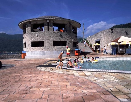
The Longdong South Ocean Park (Longdong Four Seasons Bay & Yacht Harbor) covers 16 hectares of land. It is the first multi-functional outdoor educational center in Taiwan that brings a yacht harbor and seawater swimming pools together. Every summer, swimmers and visitors who love seashore fun come here to appreciate fish and coral reefs under the sea. Also, its sea-eroded platform is one of the four open-air Coastal Ecological Classrooms of the Northeast Coast. At low tide hours, the 100 meter-odd intertidal zone becomes a natural classroom where visitors can learn about coastal creatures.
Seawater swimming pools
Longdong South Ocean Park’s Seawater swimming pools have been adapted from an illegal baby abalone farm on the sea-eroded platform. There are four such pools in total, and all are connected to the seas. Some of the pools are shallow and some are deep, but the water levels would change according to the ebbs and flows. At low tide hours, the water only reaches an adult’s waist. During high tide time, it can be as deep as three meters. Therefore, this is not only a great place to swim, but also good for scuba diving. You can even swim along with tropical fish.
Visitor Center
In the castle-like visitor center, there is a food and beverages zone, a shower area, a health center, toilets and a parking lot. In the second-floor exhibition hall, visitors can find travel info in the Northeast Coast and a display of wood sculptures.
Coastal Ecological Classroom
The sea-eroded platform of Southern Longdong is one of the four Coastal Ecological Classrooms of the Northeast Coast. According to a government survey, there are more than 60 types of large algae, more than 290 kinds of shells, more than 70 kinds of crustaceans, more than 40 kinds of echinoderms, more than 120 kinds of corals and more than a hundred kinds of coral reef fish living around the platform.
Longdong South Park Yacht Harbor
The Longdong South Park Yacht Harbor is the first of its kind in Taiwan. It is located on the southern side of the Longdong South Park and mainly serves leisure boats. Any yacht of 65 feet long or less can rest here. In total, the yacht can take 76 such boats. The harbor includes an anchoring area, land yacht storage, a scenic area and a parking lot. Management, maintenance and recycling facilities are also there.
[1] North Coast & Guanyinshan National Scenic Area
https://www.northguan-nsa.gov.tw/user/main.aspx?Lang=1
https://www.northguan-nsa.gov.tw/user/main.aspx?Lang=1
[2] Northeast and Yilan Coast National Scenic Area
https://www.necoast-nsa.gov.tw/index.aspx?lang=2
https://www.necoast-nsa.gov.tw/index.aspx?lang=2
[3] https://www.necoast-nsa.gov.tw/user/Article.aspx?Lang=2&SNo=03000430
[4] Taiwan the heart of Asia
http://eng.taiwan.net.tw/m1.aspx?sNo=0002091&id=721
http://eng.taiwan.net.tw/m1.aspx?sNo=0002091&id=721